The mobile version does not allow pan or zoom yet, please use a desktop for full use

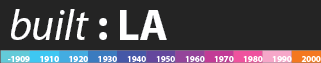
Built:LA created by Omar UretaMapbox Studio and Mapbox-GL, inspired by Portland, Oregon: The Age of a City Terrain and Label Data by Mapbox. OpenStreetMap, under ODbL.

Thanks goes out to Maptime for opening the doors to amazing cartographic possibilities!!

Code and map research can be found on Github

Hover over a building for year built

Built:LA developed by Omar Ureta (Linkedin). Made with Mapbox Studio and Mapbox-GL, inspired by Portland, Oregon: The Age of a City Terrain and Label Data by Mapbox. OpenStreetMap, under ODbL.

Thanks goes out to Maptime for opening the doors to amazing cartographic possibilities!!

Code and map update logs can be found on Github

Data // Building Outlines: LA County GIS Data Portal, Age Attributes LA County Assessor Local Roll (Note: There were buildings that had no data on the time they were built. They are shown, only greyed out.)

This map uses WEBGL, which is optimized for Chrome and Firefox, Safari users need to enable WEBGL